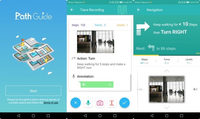
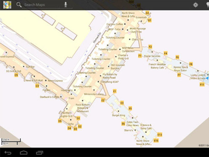
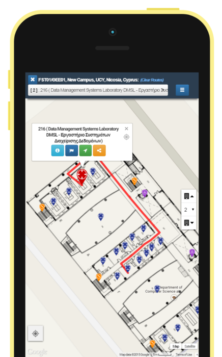
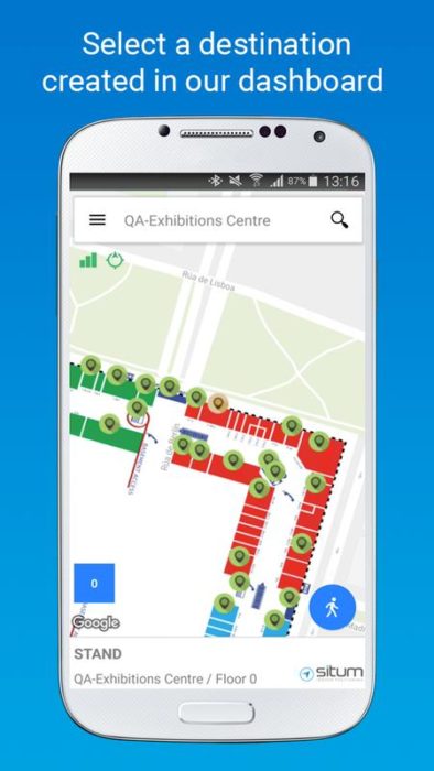
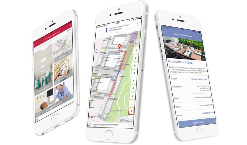
Getting lost inside massive buildings is still a common headache. GPS can guide you across cities, but the moment you step into an airport, hospital, or mall, it goes quiet. That’s where indoor navigation apps step in. These tools don’t rely on satellites. Instead, they use smart tech like BLE beacons, Wi-Fi signals, AR overlays, and even LiDAR to help you move around unfamiliar indoor spaces.
In 2025, these apps will have become essential for more than just visitors. Event organizers, hospitals, retailers, and universities now depend on them to create seamless user experiences. From guiding patients to the right department to helping shoppers locate specific stores, the use cases are growing fast.
Table of Contents
Most Reliable Indoor Navigation Software in 2025
This post breaks down the 10 most effective indoor navigation apps available today, both free and paid. We’ve compared them on real factors: precision, ease of setup, supported platforms, and how well they perform where GPS falls short. Let’s get started.
1. GoodMaps
GoodMaps is designed to simplify indoor navigation in complex buildings using LiDAR mapping and camera-based positioning. It eliminates the need for installed hardware like beacons. The app delivers audio and visual instructions, making it especially useful in airports, hospitals, and campuses. It’s also built with accessibility in mind for low-vision users.
Pros
- No need for extra infrastructure; maps are LiDAR-generated
- Supports audio guidance and text directions
- Clean, intuitive interface
- Focuses on inclusivity with screen reader support
- Works well in public transit hubs and educational spaces
Cons
- Limited availability of mapped locations in smaller cities
- The mapping process requires professional equipment
- Battery consumption can be high during camera navigation
- Not ideal for quick ad-hoc use in unfamiliar spaces
- Still expanding its coverage to private facilities and retail areas
2. Waymap
Waymap is an advanced indoor navigation app built specifically for visually impaired users. It works without GPS by using motion sensors, audio cues, and detailed step-by-step directions. The app provides real-time updates based on walking speed and body movement, making it highly precise for indoor mobility in urban spaces.
Pros
- Designed with accessibility at its core
- Doesn’t rely on Wi-Fi or GPS signals
- Works reliably in subways, malls, and transit stations
- Highly accurate step-based navigation
- Adaptive to walking pace and direction changes
Cons
- Requires proper phone placement for sensor accuracy
- Available in select regions only
- Not optimized for general-purpose indoor navigation
- The interface may feel overly focused on accessibility features
- Mapping coverage is still under expansion in major metros
3. HERE WeGo
HERE WeGo has made its mark in the indoor navigation apps space by combining global map data with indoor routing for large facilities like airports, shopping centers, and transit hubs. The app supports turn-by-turn directions and floor-level guidance, making it especially useful in unfamiliar, multi-floor environments.
Pros:
HERE WeGo offers accurate routing in complex buildings by integrating Wi-Fi signals and Bluetooth indoor positioning systems. It’s compatible across Android and iOS, with offline capabilities for mapped venues. The UI is straightforward, making it beginner-friendly. It supports smartphone indoor maps with real-time updates when available.
Cons:
The app’s indoor tracking features are limited to select locations and depend heavily on whether the venue is mapped in their system. Smaller buildings or lesser-known public spaces may lack support. Updates for indoor maps can be slow, and the indoor mode often requires manual toggling rather than automatic switching between GPS and indoor modes.
4. IndoorAtlas
IndoorAtlas blends magnetic positioning with Wi-Fi and Bluetooth beacon navigation to deliver seamless indoor mapping. It’s widely used by developers and businesses for building custom indoor wayfinding systems across malls, airports, and hospitals. The platform supports location-based services without requiring expensive new hardware, which makes it scalable and affordable.
Pros:
IndoorAtlas excels in indoor positioning accuracy, even in complex multi-level buildings. It supports AR overlays, heat maps, and real-time visitor movement tracking. It’s API-friendly and works with both Android and iOS SDKs. The platform also helps businesses understand user flow within indoor environments, supporting better space optimization.
Cons:
The setup process demands technical know-how and calibration, which might not suit smaller teams or casual users. Its strength lies more in enterprise integration than plug-and-play functionality. Without proper mapping, the experience can feel incomplete. Also, it lacks a ready-to-use app like some indoor location tracking apps, requiring separate development efforts.
5. Pointr
Pointr is a location technology platform built to handle the tough job of guiding people through indoor spaces. From massive hospitals to airports, it helps users figure out exactly where they are and where they need to go, without GPS. It works using a mix of Bluetooth, Wi-Fi, and smart software that makes real-time indoor navigation possible.
Pros:
The accuracy is impressive. Pointr doesn’t just point in the right direction—it adapts to floors, shows route changes as you move, and fits neatly into existing apps. Its heatmaps and analytics also give facility managers useful insights about visitor movement.
Cons:
The setup isn’t quick. You’ll need hardware and time to make it work properly. Plus, it’s built with larger buildings in mind. Smaller spaces or teams might find the onboarding a bit much, especially when simpler indoor positioning systems could do the trick.
6. Becomap
Becomap is a flexible platform that helps businesses build and run their own indoor location app. Whether it’s a shopping mall, airport, or university, it lets users move through large areas without confusion. It uses BLE beacons and cloud-based tools to provide indoor guidance with precision and consistency.
Pros
The standout feature is customization. Becomap offers a toolkit that allows teams to tailor maps, labels, and even wayfinding logic. It supports real-time updates, which is helpful for venues that often change layouts. Integration with third-party apps is also fairly smooth.
Cons:
Becomap works best with strong on-site tech support. Without proper beacon placement and calibration, accuracy can drop. Smaller facilities might find it harder to justify the setup. And while it’s powerful, the interface may feel slightly technical for beginners unfamiliar with location mapping systems.
7. InMapz
InMapz is a smart mapping platform designed for indoor spaces like airports, hospitals, and corporate campuses. It transforms static floor plans into interactive guides that work on both web and mobile. With indoor navigation technology, users can find directions, locate assets, and view live facility data with just a few taps.
Pros:
InMapz stands out for its automation. You can upload building layouts and the system converts them into intelligent maps. It supports Wi-Fi positioning, BLE beacons, and even QR-based location tags. Its asset-tracking features are useful for enterprises managing large spaces.
Cons:
Smaller venues may find the pricing restrictive. While powerful, the dashboard comes with a learning curve, especially for those without prior GIS or tech experience. Real-time updates also depend heavily on reliable connectivity, so performance can vary in network-limited areas. More user-friendly documentation would improve onboarding significantly.
8. ArcGIS Indoors
ArcGIS Indoors isn’t just another mapping tool. It’s designed for real-time indoor location intelligence. Built on the trusted ArcGIS platform, it allows facilities to visualize indoor assets and movement using smart layers, digital floor plans, and contextual data. Whether it’s a multi-story hospital, a busy airport, or a large corporate campus, this app helps planners and visitors stay on top of the space they’re navigating.
What makes it useful? For one, the indoor positioning technology integrates with Bluetooth beacons, Wi-Fi access points, and sensors to guide people accurately, even through complex layouts. Facility teams love the real-time analytics for tracking movement patterns. You can also integrate it with building management systems, which adds serious value for property admins.
But here’s the catch: it’s not beginner-friendly. The setup can get technical, and it’s not something you figure out over coffee. It’s better suited for enterprise use than casual personal navigation.
9. OsmAnd
OsmAnd is an open-source navigation app that’s gradually expanded into the indoor space. While it’s primarily known for offline maps and GPS tracking, recent updates now support indoor mapping for select locations. It works especially well in large public buildings like airports, malls, and museums that share detailed OSM-based floor plans.
Pros
One big advantage is its offline functionality. You can download building maps and access them without a network. It’s also highly customizable, supports plugins, and works across multiple map layers. Users who care about privacy appreciate that no personal data is sent to external servers.
Cons
Indoor navigation features are still in early stages. You’ll find limited support compared to more specialized indoor wayfinding apps. Setup can be tricky, too. Getting accurate indoor maps requires manual effort, and the learning curve is steeper for casual users.
10. Navigine
Navigine helps businesses bring precision to indoor spaces where GPS falls short. It offers location tracking through Wi-Fi signals, Bluetooth beacons, and motion sensors. From airports and malls to warehouses and hospitals, it builds a custom indoor positioning system that gives users real-time directions and lets businesses monitor movement patterns.
Pros
It’s a solid pick for those who need reliable indoor GPS apps for larger facilities. The system supports floor switching, offers strong backend analytics, and works with both Android and iOS. Developers get access to SDKs for deeper customization. Plus, you can manage maps and movement tracking through a single interface.
Cons
Navigine isn’t the quickest plug-and-play tool. It needs a proper setup and may involve technical input to fine-tune accuracy. The interface can be overwhelming at first. For smaller spaces or basic needs, simpler indoor navigation apps for Android might feel more accessible.
Conclusion
Indoor navigation is no longer a niche feature—it’s fast becoming essential. Whether you’re trying to guide visitors through a sprawling convention center or streamline operations inside a hospital, the right app makes all the difference. From real-time positioning to smart route planning, today’s indoor navigation apps offer more than just directions; they offer clarity in complex spaces. Pick what suits your need, space, and platform. Because indoors, accuracy matters just as much as mobility, and these apps help you move with confidence.
- Best Indoor Mapping Apps for Android and iOS - May 27, 2025